Location
UNLocode
Latitude 37° 57’ N Longitude 22° 58’ E
Max Draft 7.2 Time Zone GMT +2
WorldScale No
PORT DESCRIPTION
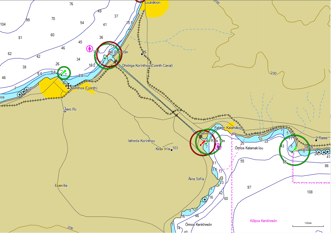
Location: The Corinth Canal is a 6,343m gorge linking the Corinthian and Saronic Gulfs.
General overview: Currents change approx every 6 hours and the waterway is much affected by NW winds. Canal depth is 8.0m, width at bottom 21m and 24.6m at sea level.
Load line zone: Summer.
Max size: no limit, moulded beam 18.3m, draught 7.2m.
NAVIGATION
Anchorages: Temporary anchorage for vessels waiting to enter the canal at Poseidonia is available in approx 29m, grey mud, between the canal entrance and Corinth, but clear of traffic using the canal entrance. Anchorage is prohibited N of the canal entrance in an area extending 1nm offshore in which there are submarine cables.
Tridal range and floe: Range 0.6m.
Dock density: 1025.
Charts: BA 1600. Admiralty Pilot NP47.